There is a story told… of a land beyond the Western edge of the Mediterranean Sea. A land populated by a civilisation of great advancement… and great military prowess.
But this land is no more. It was swallowed up by the waves long long ago… along with its people, its technology, and its memory.
It slipped out of history, and into the pages of storybooks… into the realms of legend and mythology.
Key Takeaways
- The Richat Structure in Mauritania, known as the ‘Eye of the Sahara,’ is a 50-kilometer-wide natural geological formation of concentric rock circles.
- Some fringe theorists claim the Richat Structure matches Plato’s description of Atlantis, citing its circular rings, possible canal connections, and proximity to mineral-rich regions.
- The Sahara was significantly wetter during the African Humid Period (14,500–5,500 years ago), potentially supporting elephants and civilization around the time Plato dated Atlantis.
- The Richat Structure’s rings are confirmed natural formations from sedimentary erosion and volcanic activity, not artificial canals or city walls.
- No archaeological evidence of a lost civilization has been found at Richat, and scholars generally consider Plato’s Atlantis an allegorical invention rather than historical fact.
Of course… I’m talking about the great lost civilisation of Atlantis… something which has inspired everything from the writings of Jules Verne and Arthur Conan Doyle… to the work of the Disney Corporation and DC Comics.
These days, most people who search for Atlantis go here… to novels and comic books, or to the flickering images of movies and TV shows. But not everyone.
Some people still maintain that Atlantis was indeed a real city, and that Atlanteans were indeed a real civilisation.
And for a few of these people… that great ancient nation was not located somewhere out in the wilds of the Atlantic Ocean… but instead, somewhere more unexpected:
…in the broad, scorching sands of the North African Desert… within the strange, eerie rings of the Richat Structure… also known as, the ‘Eye of the Sahara’.
But surely this is all a fantasy. Surely trying to find Atlantis is like trying to find Santa’s workshop… or hunting the tooth fairy.
Well… let’s not be quite so quick to judge. While these theories certainly are ‘fringe theories’… it’s not quite right to call them ‘fantasy’. There is some evidence to support these ideas.
In this video, we’re examining this evidence more closely. We’re taking a look at Mauritania’s stunning Richat Structure… and asking… ‘could this really be the site of the lost city of Atlantis’?
Or… is it just a pretty set of rocks… out there in the Sahara desert.
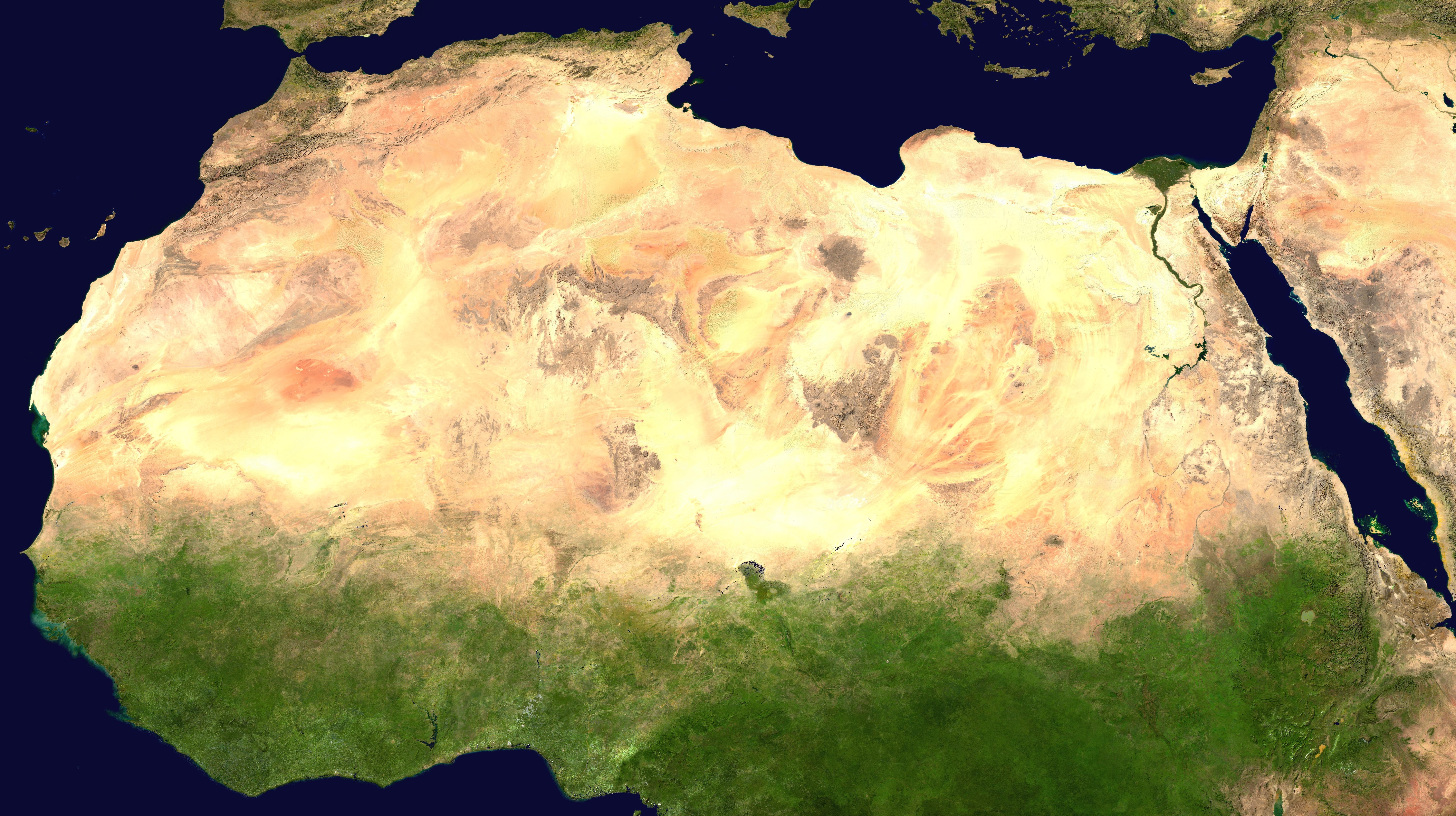
To call the Sahara a ‘vast, featureless desert’ is somewhat unfair on the Sahara. Look down on that arid surface from above… perhaps from a spacecraft, or an airliner… and you will see that it is certainly vast… but ‘featureless’? Absolutely not…
The desert surface is criss-crossed by the dark blotches of mountain ranges. The tiger stripes of rock and dune wind their way across the landscape… weaving their patterns into the sand in various shades of red, orange and yellow.
In the east, the famous blue line of the river Nile pushes its way north, bringing cultivation and civilisation to the region… like it has done for many thousands of years.
So the Sahara is not ‘featureless’… but it’s not necessarily ‘hospitable’ either. As you scan the sprawling desert, you might wonder how humanity could ever survive here. There’s nothing very ‘welcoming’ about the Sahara.
Unless, of course, you venture far enough west, into Mauritania. Here, if your eyes are sharp enough as you peer down from the sky… you might notice another eye, peering back at you.
This bizarre formation resembles a cross between the ‘Eye of Sauron’ from ‘The Lord of the Rings’… and a gas cooker turned up to full blast. It’s known as the ‘Eye of the Sahara’. But its more formal name is the Richat Structure… which comes from an old Berber word for ‘feather’. The local population tend to mix the two names, calling it:
“Guelb er Richât,”
Or…
“The eye of the Richat.”
These enormous rock formations are incredible to behold… and it’s no surprise that they are the subject of some pretty wild theories. For some, this is the site of the great lost civilisation consumed by waves and water… the great lost civilisation of Atlantis.
But before we get into these theories… we need to do a bit of housekeeping. We need a quick rundown of what this thing is, what it’s composed of, how it got there, and who discovered it.
Let’s begin with ‘what it is’.
This is actually quite an easy question to answer…
The Richat Structure is an enormous sequence of rocky cliffs and buttresses, on the the Adrar Plataeu in northwestern Mauritania.
It is arranged in a pattern of concentric circles, and on average, it is about 31 miles, or 50 kilometres in diameter. This means it covers more than 750 square miles, or almost 2000 square kilometres,
Well that’s that sorted…
But the questions of what it’s composed of, and how it got here, are a little more complex.
The structure is largely composed of sedimentary rock… in other words, rocks that are formed over millennia of sediment buildup. This sediment is crushed under the pressure of the Earth, until it forms into stone.
Some of these rocks are harder and more wear-resistant than others. So the softer sedimentary rock is worn away by wind and rain, and the harder stuff stands tall… creating the strange ridges that we see today.
Within that sedimentary rock, there are cores of igneous rock too. While sedimentary rocks emerge over thousands of years, igneous rocks are formed differently. The Earth creates these rocks far more quickly, with a lot more drama, and a lot more fire.
At Richat, we find a specific type of igneous rock, known as ‘gabbro’. Gabbroic rocks are formed by the immense heat and pressure of volcanic activity, followed by a slow phase of cooling.
When these gabbroic rocks cool, their dimensions change. This generates huge forces, which push the rock deep into the nearby sedimentary formations. At Richat, this probably took place during the Cretaceous period, between 66 and 145 million years ago.
At the centre of the formation is what geologists refer to as a “domed anticline”. This essentially means a large plateau of curved rock, which has built up over time, so that the oldest section of the stone is at its centre.
This is the ‘pupil’ of the eye when it is seen from above. But it’s also a central bastion for the structure as a whole. If a civilisation had existed here, this seems like it would be a good place for its capital.
Ok… so what about its discovery?
In the modern era, the Richat structure was probably first discovered in the 1930s or 40s by French researchers.
Back then, it was referred to as the Richat Buttonhole, due to its shape. It was also referred to as the Richat Crater… because it was believed to be the site of a meteorite strike. This meteorite crater theory is now almost completely disregarded.
By 1948, geologists like Jacques Richard-Molard were surveying the region. And by 1952, Theodore Monod was leading a large-scale geological expedition into the structure for the first time. ‘The Eye of the Sahara’ had arrived on the western geological scene.
But the word ‘western’ is important here. This is probably another example of Western scientists and explorers trumpeting their supposed ‘discoveries’… when, in fact, local peoples have known about this place for hundreds of years.
Possibly even thousands of years.
With a structure this vast, humanity is presented with a bit of a problem. We are not very good at recognising something until we gain some perspective on it.
You could stand right next to the ‘Eye of Sahara’, but you’d only see the vast rolling escarpments and towering rock formations… you wouldn’t see the concentric circles, and you wouldn’t gain the whole picture.
This is similar to what happened to the Nazca Lines in Peru. These lines were visible on the floor of the deserts in eastern Peru and northern Chile for around 2,000 years… but no one paid much notice.
Then, in the 1920s, pilots began flying over the desert. When they looked down at the landscape below them, they noticed something incredible. The surface was covered with enormous drawings of things like animals and plants, and even humans.
The Nazca Lines had been ‘discovered’… or at least ‘re/discovered’… even though they were right under human noses the entire time.
In June of 1965, the Richat Structure had its own ‘Nazca Moment’. As the Gemini Four astronauts Ed White and James McDivitt peered down from their spacecraft, they snapped an incredible picture.
They had photographed the Eye of the Sahara from space, for the first time.
Suddenly, humanity was confronted with the drama of the Richat Structure. … And the wild theories about its history were not far behind…
Let’s take a step away from the worlds of geology and geography for a second… and let’s step back into antiquity. If Atlantis was a real ancient civilisation, then surely our ancient ancestors would have had plenty to say about it.
A number of civilisations flourished around the ancient Mediterranean. Over in the east, the Egyptian civilisation blossomed along the banks of the Nile, watched suspiciously by the Hittites to the north.
Elsewhere, the Minoans were already doing pretty well on Crete almost 5,000 years ago. A little later, the Phoenicians were setting out from the Middle East, spreading their wealth and cultural influence across the region, and eventually founding Carthage, in North Africa.
The Mycenaeans were one of the earliest great civilisations in mainland Greece, more than 3,500 years ago. And then we have the great Peloponnesian states, followed by the Roman Republic and the Roman Empire.
There’s almost no debate around this. It’s pretty much 100% accepted as historical fact, right across the board. But if we shift our focus to the furthest west point of the Mediterranean, and then move a little further out into the Atlantic… then, we encounter a civilisation which is very hotly debated:
… Atlantis.
Atlantis has slipped in and out of accepted history several times over the centuries. It first emerges in two of Plato’s dialogues, Timaeus and Critias, written in the 5th Century BC.
Plato described an island which was “beyond the Pillars of Hercules”, which is how he would have referred to what we now know as the Straits of Gibraltar.
The Atlantian civilisation supposedly existed 9,000 years before Plato’s time, which would make it about eleven-and-a-half thousand years old today.
So what does Plato actually say about Atlantis? Well, in the Critias dialogue, he says this:
“This power came forth out of the Atlantic Ocean, for in those days the Atlantic was navigable; and there was an island situated in front of the straits… which are by you called the Pillars of Heracles…”
It was a wealthy island, and also a militarily successful island. Atlantean armies and navies conquered huge swathes of the Mediterranean. As Plato says in Critias:
“9,000 years have passed since the war between the people dwelling outside the Pillars of Heracles and those dwelling within.”
They weren’t just an ocean-going power either. Under the command of the great Atlantean kings… there was an enormous land force. To quote Plato again:
“For the service of the war they made use of as many as 10,000 chariots, and also a corresponding number of horses and riders, and light chariots…”
But their warlike spirit was no match for the Athenians. According to Plato, Athens defeated Atlantis in battle.
Atlantis’s utopian kingdom was also no match for the forces of nature. Earthquakes and tsunamis finally sank the island, and consigned Atlantis to the mists of history.
All of this seemed to take place in less than 24 hours. In Timaeus, Plato says:
“…in a single day and night of misfortune, all your warlike men in a body sank into the earth, and the island of Atlantis, in like manner, disappeared in the depths of the sea.”
And in Critias, Plato says something similar:
“But in the course of one portentous day and night, the island of Atlantis, in like manner, sank into the sea and vanished; and because of the violent earthquake and flood of waters, it fell into the depths of the earth and the sea. For which reason, the sea in those parts has become impassable and unsearchable, being blocked up by a shoal of mud that the subsidence brought forth.”
This second passage is very interesting. It suggests that Atlantis was originally buried by the sea, but that the conditions in this part of the world have since changed.
Rather than league upon league of seawater smothering the remains of the civilisation… Plato instead talks of mud and sediment, suggesting the remains might be located on land.
But let’s hold on just a second here… as we are getting ahead of ourselves. Just because Plato talks about Atlantis… does not mean that Atlantis was a real place.
Plato is one of the fathers of modern philosophy… and he was certainly not a historian. With his dialogues, Plato was offering a cautionary tale of what happens when a utopian society subverts the natural hierarchy of god and man.
In his writing, Plato wanted to warn humanity about the dangers of becoming too arrogant, and too assured of its own prowess. The flourishing of Atlantis… and its messy downfall beneath the ocean waves… is an allegory. It’s not necessarily historical fact.
But… to be fair on Plato… he does show us his ‘working’.
Plato tells us that the story of Atlantis came from the Athenian lawgiver Solon, who lived about 200 years before the dialogues were written. In Plato’s own words:
“At the head of the Egyptian Delta, where the river Nile divides, there is a […] great city […] called Sais, [from] which Amasis the king was sprung.
The citizens of this city are great lovers of the Athenians, and say that they are in some way related to them.
Thither came Solon, who was received by them with great honor. He asked the priests, who were most skilful in such matters, about antiquity. [He then discovered] that neither he, nor any other [Greek], knew anything worth mentioning about the times of old.”
So… assuming that Plato didn’t just invent Atlantis for his own rhetorical purposes… is there anything historically verifiable about this story of Solon, and his travels to Egypt?
Well… yes… in a way. Historians believe that Solon did indeed exist, and did actually visit Egypt. He spent at least a decade outside of Athens, and the later Roman historian Plutarch says that Solon spent these years…:
“…on the Canopian shore, by Nile’s deep mouth.”
So Plutarch corroborates Solon’s journey to Egypt, and it’s highly likely that such a learned man as Solon would have conversed with similarly learned men on these ‘barbarian’ shores. But how do we know that the Egyptian priests and scholars had any information that was worth sharing?
Well… we don’t know this. But we do know that the Greeks of the 1st Millennium BC considered the Egyptians to be sagelike and wise.
Around 70 years before Plato wrote down his dialogues, the celebrated historian Herodotus was working on his own magnum opus… the ‘Histories’.
In the ‘Second Book of the Histories’, published in 440 BC, Herodotus speaks of his own journey to Egypt… that he made 10 years earlier… and of his own experience there. He says:
“They said that the sun had four times moved from his wonted course… and that nothing in Egypt had changed, neither the products of the river nor the produce of the land.”
It’s not much… but Herodotus’ words do suggest that Egyptian wisdom was highly sought after in Ancient Greece. It’s possible that Plato was writing about a story that Solon had heard during his travels on the banks of the Nile.
Later readers of Plato’s dialogues certainly did seem to view Atlantis as a real place. Early Arab cartographers included it in some of their maps, and medieval European scholars seemed to take much of Plato’s writings on Atlantis at face value.
Watch Now
Open Video
Video Briefing
The Richat Structure: The Real Atlantis?
In the Early Modern Period, scholars began looking for potential sites of where Atlantis might have been.
The Canary Islands were an obvious choice, as they are beyond the Straits of Gibraltar, off the west coast of Africa. Scandinavia, and even the New World of America, were also put forward as potential candidates. But no one could ever agree on exactly where the island might be, and over time, the legend drifted out of history again.
Just like the waters of the Atlantic had supposedly covered over the island and its people so many thousands of years ago… the mists of myth and legend erased its story from the history books.
But is this actually fair? Is the real reason that scholars never found Atlantis… simply that they were looking in the wrong place?
More recently, new theories have emerged about Atlantis. When the idea of ‘the Bermuda Triangle’ became popular in the 1970s, writers like Charles Berlitz began to connect this to Atlantis. Berlitz believed that the triangle had swallowed the ancient civilisation up, just like it supposedly swallows up ships and planes.
Needless to say, few people took this theory seriously… and it has remained on the fringes.
Another theory emerged after Charles Hapgood wrote his book ‘Earth’s Shifting Crust’ in 1958. Hapgood’s theory states that a cataclysmic shift of the Earth’s tectonic plates 12,000 years ago pushed Antarctica northwards. This made the frozen continent far more temperate, and far more able to sustain life. Therefore… Atlantis and Antarctica may be ‘one and the same’ thing.
Over the last 70 years, however, our understanding of plate tectonics has developed rather a lot. Nowadays, Hapgood’s theory is not really considered a viable explanation for Atlantis.
Even more recently, other fringe theories have come to light… replacing the largely forgotten ideas of the Bermuda Triangle and Antarctica. One such theory is that Atlantis is in fact ‘the Eye of the Sahara’ in Mauritania.
A few people have thrown their support behind this idea. Now, as this is a ‘fringe theory’, its supporters are not necessarily respected academics or global leaders in their respective fields.
But as the purpose of this video is to interrogate this theory… their voices need to be heard.
First up, we have the writer and publisher Lee McQueen. She seems pretty certain that ancient Atlantis was located at Richat. In McQueen’s own words:
“Plato’s description of Atlantis was neither random, nor coincidence. All clues provided by Plato, and other historians and geographers, point towards the Richat Structure and the ancient culture that once grew around it.”
Another supporter is the writer and spiritual teacher Paul Wagner. Wagner adopts a slightly more conspiratorial tone when discussing Atlantis and Richat… as if ‘the powers that be’ might be trying to keep it secret from us.
Wagner says:
“Plato and Solon were known to have integrity and were, therefore, rarely challenged. Atlantis is the only story of Plato’s that was ever disputed. One of the strangest aspects of the history of Atlantis is that none of these theories are presented in Wikipedia, and every related page is locked. This includes pages about the Eye, King Atlas, and the God Poseidon. How is it that the universally accepted concept that Atlantis existed is left out of one of society’s most treasured resources?”
But… do these theories really hold any weight? To find out, let’s go back to our earliest… and only… source for Atlantis: the writings of Plato.
These days… most of us think of Atlantis as a sort of fortress city rising out of the sea, perched upon a small island in the middle of the ocean. But this is not really how Plato describes the landmass.
First of all, Plato makes it quite clear that Atlantis was not one single island at all.
In his Timaeus dialogue, the philosopher writes that:
“Atlantis was not just a single island, but had dominion over many other islands and parts of the continent.”
In Critias, Plato talks of “a central island”, surrounded by a series of rings… which were made up of land rings and sea rings. To quote the great philosopher:
“The sea ring next to the central island was 1 stadium wide, and the land ring next to it was of equal breadth. The next sea ring was 2 stadia, the next land ring 2 stadia, and the outermost sea ring was 3 stadia wide. The diameter of the whole was 127 stadia.”
He also tells us of a central hill, and a temple built upon it:
“In the center of the island, there was a hill, and on this hill one of the original ten kings, Poseidon’s son, built a temple to his father. Around it he built a circle of land and sea, creating two rings of land and three of water, all perfectly circular and equidistant from each other.”
All of this sounds pretty familiar. We already know all about a vast structure of concentric circles, covering an enormous area. And of course, this is the Richat Structure, or the Eye of the Sahara.
Yes, Plato talks about a diameter of 121 stadia… which is only about 22 kilometres. This is less than half of the diameter of the Richat structure, as observable today. But, as we’ve said, Plato was not a historian… so perhaps it doesn’t matter that he doesn’t have his dimensions exactly right.
Ok… but the Richat structure is located on land. If it truly was Atlantis, shouldn’t it be at the bottom of the sea?
Again… we find an answer for this in Plato’s dialogues. You’ll remember that he told us:
”… the sea in those parts has become impassable and unsearchable, being blocked up by a shoal of mud that the subsidence brought forth.”
On top of this, Plato also tells us that:
“This island was larger than Libya and Asia put together…”
Now, Plato wouldn’t have known how big Asia was. He wouldn’t have known anything about China or the far East of Siberia, or about the sprawling Malaysian and Indonesian archipelagos. So we can probably assume he’s talking about Asia Minor here… places like Anatolia and Persia, stretching as far as western India and Pakistan.
But even if we take this as our reference point, this is still a huge area of land. So it’s not impossible that Plato was referring to something like the Richat structure, which is located on a huge landmass, and is far from the ocean.
In fact, Plato goes a little further in Critias. He hints that the Atlantean capital was not directly adjacent to the sea… but was instead connected to the ocean by large canals:
“They bridged the rings with causeways, and carved tunnels under the sea rings so ships could pass through… There was a great canal from the sea, 100 feet deep and 3 plethra (92 meters) wide, leading to the outermost waterway.”
There’s also another part of Plato’s description that could suggest Mauritania as the site of Atlantis. Plato writes in Critias:
“The entire circuit of the wall, which went round the outermost zone, they covered with a coating of brass, and the circuit of the next wall they coated with tin, and the third, which encompassed the citadel, flashed with the red light of orichalcum.”
This is a very striking image. It suggests a metal-coated citadel that would have glinted in the sun, dazzling all who laid eyes upon it.
For this to be possible… Atlantis would need to be located in a land that is rich in these kinds of metals. And West Africa is exactly that land.
While Mauritania itself doesn’t produce much tin or bronze, it is located reasonably close to more mineral-rich regions… like Nigeria and Niger.
As for orichalcum, this is believed to be an alloy of gold and copper. It was known for being very expensive, which suggests that no one was going to be coating a vast city in it. But this is West Africa we’re talking about.
The lands of western Africa, including Mauritania, would later become the domain of Mansa Musa… who is believed to be the richest man in history.
In the early 14th Century AD, Mansa Musa apparently went on Hajj, travelling from his kingdom of Mali, to Mecca on the Arabian Peninsula. On his way, he passed through Egypt, where he became very popular thanks to his habit of doling out vast amounts of gold to whoever he encountered.
The flood of gold into Egypt actually crashed the region’s economy for ten years, and sent precious metal prices plunging. While the stories of Atlantis and Mansa Musa are more than 10,000 years apart, they do show that the region has an abundance of highly valuable materials.
So it’s not impossible that this would have been used to armour-plate a city… assuming you had enough of it lying around.
Ok… so the evidence so far is a little threadbare… but it’s ‘hanging on in there’. It does just about match up with what we know about Richat and Mauritania in general.
However, if we look further into Plato’s description in Critias, we encounter a few problems. Here, Plato writes:
“The island had a great number of elephants, for there was ample provision not only of marshes and lakes and rivers, but of meadows — enough food for every sort of wild animal, both for those that live in mountains and those that live in plains — and in particular for the largest and most voracious of all, the elephant.”
Now this doesn’t sound anything like Richat, or like anywhere in Saharan Mauritania at all.
As I said earlier on… the Sahara isn’t exactly a featureless blank on the map… but it’s not exactly a tropical oasis either. There isn’t much to sustain life here… especially not, to quote Plato, the “largest and most voracious of all” life.
However… this probably wasn’t always the case.
As early as 1850, the German Heinrich Barth was discovering intriguing Petroglyphs in the Murzuq Desert in Libya. While the desert was completely arid and devoid of water, the petroglyphs depicted a more verdant landscape, complete with larger animals like aurochs and other creatures that simply could not survive in this environment.
Over the next century, more petroglyphs were discovered, giving rise to the theory of massive climate change in the Saharan region.
More recent research has reached something of a consensus. The African Humid period began around 14,500 years ago, and ended around 5,500 years ago. During this time, the Sahara would have been a more temperate land, supported by a vast network of rivers and lakes.
There would have been grasses and trees, and abundant sustenance for herbivores like elephants. As the population of herbivores grew, carnivore populations would have been similarly sustained. And so the region would have been teeming with life.
And yes, the date proposed by Plato for Atlantis was 12,000 years ago… which would have put it right within this African humid Period.
There’s also the ‘Younger Dryas’ period to consider. This climatological concept gets brought up quite a lot when we’re discussing fringe theories of human history and archaeology. You may remember it from our video on the underground cities of Cappadocia in Turkey.
Basically, the Younger Dryas works like this. Towards the end of the last ice age, around 13,000 years ago, the Earth was gradually warming. Then, around 12,900 years ago, this trend rapidly reversed.
The Earth began cooling again… at an alarming rate. Over the next 1,300 years, the temperature in the northern hemisphere fell by around 5 degrees Celsius, causing havoc to ecosystems across the region.
Then, as the Younger Dryas ended, the planet began warming once more. Again, this happened at an alarming rate. These kinds of rapid changes were too much for many species, and mass extinctions were common, particularly among large mammals like mammoths.
This rapid warming also released huge amounts of water that had been tied up in ice sheets and ice caps, which poured across the land. Geological data shows that enormous lakes formed in North America during this time,such as the sprawling Lake Agassiz, which would have been bigger than all of the North American ‘Great Lakes’ combined.
This would surely have impacted North Africa too, creating enormous areas of water to support local flora and fauna. The Younger Dryas period is a little outside the accepted timeline for Plato’s Atlantis. However, it does show us that massive climatic shifts were not only possible in the Sahara… but actually did happen on more than one occasion.
All of this is very nice… and I suppose it presents a fairly compelling argument for the Richat Structure as the true site of Atlantis. But we’ve got to think critically here… and we’ve got to ask… is it really true?
It would be lovely to just say ‘yes… we found it… Atlantis was here’.
But… we’re not going to be able to do that. And here’s why.
The evidence that Richat truly was Atlantis is very much ‘quantity over quality’. It’s largely based on the fact that some details seem to marry up… a bit… with Plato’s descriptions.
Yes, Richat’s concentric circles do match Plato’s dialogues. And yes, the climate of the Sahara has shifted enormously over the millennia, over a timeframe that just about reflects Plato’s own timeline.
But it’s all still just circumstantial evidence. There’s no actual proof that this was Atlantis… or that Atlantis ever existed at all.
Firstly, there’s no evidence that the concentric circles were developed as canal structures like Plato mentions. They are instead natural rock formations. We know this… this is a fact.
Yes, they are rather peculiar, unexpected natural rock formations… in the middle of a sprawling desert. But there’s absolutely no mystery about how they were created. Around the world, we see examples of sedimentary rocks eroded by wind and water, and leaving pillars and chasms behind.
Uluru in Australia is an example of this, as are Petra and the Wadi Rum in Jordan. And Meteora in Greece, and Zhang Jia Jie in China, as well as an almost endless list of other geological oddities.
The fact that similar formations exist in Mauritania is not evidence for anything… other than for some very cool rocks.
Secondly, massive climatic changes certainly did take place in North Africa during the Younger Dryas and the African Humid Period, but they took place in plenty of other locations too. The Younger Dryas in particular would have impacted the entire northern hemisphere… at the very least.
So yes, floods would have happened right here in Richat. But they would have happened in many other places too. We can’t point our finger at Richat and say for certain that ‘this was Atlantis’.
The same applies to Plato’s description of the size of Atlantis. When Plato tells us that the archipelago was the size of Libya and the known part of Asia combined, he’s describing a landmass that encompassed two-thirds of his own ‘known world’.
Maybe this matches the dimensions of North Africa. But Plato would have known about North Africa. So why would he not say… ‘Atlantis was the size of North Africa’. Or, better yet, Atlantis was in North Africa.
He doesn’t say this. So we can’t glean from Plato’s dialogues that the Atlantean capital was definitely in Mauritania.
Finally, we need to come back to a point we discussed earlier on. Plato was a philosopher, not a historian. His dialogues are not supposed to be historical records. They are supposed to be literary constructions, which provide allegorical meaning.
Plato had absolutely no duty to provide historical facts to his readers. He didn’t claim to do so… and he wouldn’t have felt that he needed to. Plato’s Atlantis could very easily be… made up.
If Atlantis was just a figment of Plato’s incredible imagination and creativity… the legendary landmass could have still made its way onto medieval maps and charts.
Medieval scholars and thinkers had an enormous amount of respect for the ancients who went before them. If Plato was writing about Atlantis, then Medieval scholars may have taken this as proof that Atlantis existed.
These days, we tend to think a bit more critically about our sources.
But perhaps the biggest problem with the Richat theory is this: there is absolutely no archaeological proof.
The region has been explored by scientists and researchers for decades, and they’ve found absolutely nothing to suggest there was once a great civilisation here… not one shred of evidence.
This is especially problematic when you consider that the Atlantean capital was supposed to be encased in metal. Even if the site is more than 12,000 years old… wouldn’t there be some of this metal left over, giving us a clue as to its former grandeur?
If we shift our focus further east, to the plains of south-eastern Anatolia, we find a very real archaeological site of a similar age to the fabled Atlantis. This is Göbekli Tepe in modern-day Turkey. It’s about 11,500 years old… and it’s absolutely teeming with artefacts, and items of archaeological note.
If Atlantis was located in Mauritania… then surely we’d find the same things here. But we don’t… and this lack of an archaeological record is pretty damning.
It all looks a bit bleak for the romantic theory of Richat, and its Atlantean past. The scholarly consensus these days is a little more boring. Scholars now tend to believe one of two things…
One… that Plato just invented Atlantis for his own rhetorical and allegorical purposes.
Or… two… that Plato based his work on a conflation of several different events… learned from the teachings of the priests and archivists that Solon met in Egypt.
For example, Plato may have been inspired by the flooding of the Black Sea, around 5,000 years earlier. Until around 5600 BC, the Bosporus formed a land bridge between Asia Minor and Europe.
In just over a year, the Mediterranean rose significantly, flowed over the Bosporus, and into the freshwater lake on its northern side. The subsequent inundation of salt water formed the Black Sea that we know today, and would have destroyed settlements and claimed lives right along its banks.
Another source of inspiration for Plato may have been the earthquake and volcanic eruption on the island of Thera… which is now Santorini. This catastrophe took place around 1600 BC, and possibly wiped out the Minoan civilisation. Again… this sounds a lot like what supposedly happened to Atlantis.
Finally, there is the story of the mysterious ‘Sea People’. These rampaging tribes waged wars against the Egyptian and Hittite civilisations, and may have contributed to the Bronze Age collapse of around 1200 BC.
It’s entirely possible that Plato wove his allegorical dialogues out of a combination of these real-life events. And it’s also entirely possible… that he just made it all up.
After all, Plato is also famous for writing about ‘a cave’. We don’t go looking for this cave, because we understand that it wasn’t real… Plato invented it.
So… is the Eye of the Sahara truly the site of Atlantis? It’s a nice story… and I suppose we can’t rule it out 100%.
But with a serious lack of evidence… we’ve got to say… probably not.
Simon Whistler
Simon Whistler is one of YouTube's most prolific educational creators. Decoding the Unknown is his methodical investigation into the world's strangest phenomena — examined with rigour, curiosity, and a healthy dose of scepticism.
Frequently Asked Questions
What is the Richat Structure and where is it located?
The Richat Structure, also known as the ‘Eye of the Sahara,’ is an enormous sequence of rocky cliffs and buttresses on the Adrar Plateau in northwestern Mauritania. It is arranged in a pattern of concentric circles, averaging about 31 miles (50 kilometers) in diameter, covering more than 750 square miles (almost 2,000 square kilometers). Its name comes from an old Berber word for ‘feather.’
How was the Richat Structure formed?
The Richat Structure is largely composed of sedimentary rock formed over millennia of sediment buildup. The softer sedimentary rock was worn away by wind and rain, while harder rock remained, creating the strange ridges seen today. Within the sedimentary rock are cores of igneous rock called gabbro, formed by volcanic activity during the Cretaceous period (66-145 million years ago). At the center is a ‘domed anticline’—a large plateau of curved rock with the oldest section at its center.
When and how was the Richat Structure discovered by the modern Western world?
The Richat Structure was probably first discovered in the 1930s or 1940s by French researchers, who called it the ‘Richat Buttonhole’ and initially believed it was a meteorite crater. By 1948, geologist Jacques Richard-Molard was surveying the region, and by 1952, Theodore Monod led the first large-scale geological expedition. Its ‘Nazca Moment’ came in June 1965 when Gemini Four astronauts Ed White and James McDivitt photographed it from space, making its dramatic concentric circles widely known.
What does Plato say about Atlantis in his dialogues Timaeus and Critias?
Plato described Atlantis as an island ‘beyond the Pillars of Hercules’ (Straits of Gibraltar) that existed 9,000 years before his time (about 11,500 years ago). It was wealthy and militarily powerful, with 10,000 chariots and vast armies that conquered much of the Mediterranean. Athens defeated Atlantis in battle, and the island was destroyed by earthquakes and tsunamis in ‘a single day and night of misfortune,’ sinking into the sea. Plato also noted the sea became ‘impassable and unsearchable, being blocked up by a shoal of mud.’
How do supporters of the Richat-Atlantis theory explain the fact that Richat is on land, not under the sea?
Supporters cite Plato’s statement that ‘the sea in those parts has become impassable and unsearchable, being blocked up by a shoal of mud that the subsidence brought forth,’ suggesting conditions changed and remains might be on land. They also note Plato described Atlantis as ‘larger than Libya and Asia put together,’ implying a huge landmass rather than a small island. Additionally, Plato mentioned canals connecting the capital to the ocean, suggesting it was not directly on the coast.
What evidence from Plato’s description seems to match the Richat Structure?
Plato described ‘a central island’ surrounded by rings of land and sea—two rings of land and three of water, all perfectly circular and equidistant. This matches Richat’s concentric circular structure. Plato also mentioned a central hill with a temple, corresponding to Richat’s ‘domed anticline’ at its center. The diameter Plato gave (127 stadia, about 22 kilometers) is less than half of Richat’s current diameter, but supporters argue Plato wasn’t a historian and may not have had exact dimensions.
How do supporters explain Plato’s description of elephants and abundant vegetation at Atlantis?
They point to the African Humid Period (14,500 to 5,500 years ago), when the Sahara was more temperate with rivers, lakes, grasses, and trees that could sustain elephants and other wildlife. Plato’s date for Atlantis (12,000 years ago) falls within this period. The Younger Dryas period (12,900 years ago) also caused rapid climate changes and flooding in the northern hemisphere, showing massive climatic shifts were possible in the region.
What are the main problems with the theory that Richat was Atlantis?
The evidence is circumstantial rather than conclusive. The concentric circles are natural rock formations, not artificial canals—similar formations exist worldwide (Uluru, Petra, Wadi Rum, Meteora). Climate changes affected many locations, not just Richat. Plato was a philosopher writing allegory, not history, and may have invented Atlantis entirely.
Most critically, there is absolutely no archaeological evidence of a civilization at Richat—no artifacts, no metal remains despite Plato’s description of metal-coated walls, nothing comparable to sites like Göbekli Tepe in Turkey of similar age.
What do scholars believe Plato may have based Atlantis on, if not a real place?
Scholars tend to believe either that Plato invented Atlantis entirely for rhetorical and allegorical purposes, or that he conflated several real events learned from Egyptian priests through Solon. Possible inspirations include: the flooding of the Black Sea around 5600 BC when the Mediterranean flowed over the Bosporus; the earthquake and volcanic eruption on Thera (Santorini) around 1600 BC that possibly destroyed the Minoan civilization; and the mysterious ‘Sea Peoples’ who contributed to the Bronze Age collapse around 1200 BC.
Who are some supporters of the Richat-Atlantis theory and what do they claim?
Writer and publisher Lee McQueen claims ‘Plato’s description of Atlantis was neither random, nor coincidence’ and that ‘all clues provided by Plato, and other historians and geographers, point towards the Richat Structure.’ Writer and spiritual teacher Paul Wagner takes a more conspiratorial tone, noting that ‘none of these theories are presented in Wikipedia, and every related page is locked,’ suggesting suppression of information. However, the article notes these are ‘fringe theory’ supporters who are ‘not necessarily respected academics or global leaders in their respective fields.’
Sources
- Original Decoding the Unknown video: The Richat Structure: The Real Atlantis?
- https://en.wikipedia.org/wiki/The_Maracot_Deep
- https://upload.wikimedia.org/wikipedia/commons/a/a7/Sahara_satellite_hires.jpg
- https://www.nasa.gov/image-article/richat-structure-mauritania-2/
- https://www.britannica.com/place/Richat-Structure
- https://science.howstuffworks.com/environmental/earth/geology/eye-of-the-sahara.htm
- https://coolconversion.com/geometry/circle/area/index.php
- https://www.britannica.com/place/Richat-Structure
- https://www.ancient-origins.net/unexplained-phenomena/richat-structure-0016927
- https://www.worldhistory.org/article/665/nazca-lines/
- https://www.nasa.gov/centers-and-facilities/kennedy/gemini-iv-learning-to-walk-in-space-2/
- https://science.nasa.gov/earth/earth-observatory/eyeing-the-richat-structure/
- https://www.cambridge.org/core/books/abs/rulers-and-ruled-in-ancient-greece-rome-and-china/chronology-of-the-ancient-mediterranean/31E66BA8C88CDCC71CCE64AEF5B2A276
- https://en.wikipedia.org/wiki/Atlantis
- https://www.britannica.com/list/6-lost-civilizations
- [https://en.wikipedia.org/wiki/Histories_(Herodotus](https://en.wikipedia.org/wiki/Histories_(Herodotus)
- https://www.history.com/articles/top-6-theories-about-atlantis
- https://medium.com/@leemcqueen3/yes-the-richat-structure-was-the-central-city-of-atlantis-91022a15e600
- https://www.gaia.com/article/has-the-city-of-atlantis-been-discovered-in-the-eye-of-the-sahara
- https://www.convertunits.com/from/stadia/to/kilometer
- https://thechinaproject.com/2020/02/17/did-plato-and-the-ancient-greeks-know-about-china/
- https://oec.world/en/profile/bilateral-product/raw-tin/reporter/nga
- https://en.wikipedia.org/wiki/Orichalcum
- https://theafricandreamsl.com/how-mansa-musa-nearly-bankrupted-egypt-and-crashed-its-economy/
- https://en.wikipedia.org/wiki/African_humid_period
- https://www.britishmuseum.org/collection/object/E_2013-2034-3558
- https://scienceinsights.org/what-is-the-younger-dryas-and-why-does-it-matter/
- https://biologyinsights.com/when-did-mammoths-go-extinct-a-surprising-timeline/
- https://www.worldheritagesite.org/connections/sandstone-formations/?sort=name&sort_dir=asc&page=1
- https://www.library.upenn.edu/events/lawrence-j-schoenberg/interpreting-ancients
- https://www.history.com/articles/top-6-theories-about-atlantis
- https://www.worldhistory.org/Bronze_Age_Collapse/
- Hero image source by Tawhid Sadman / openverse, cc0.